
San Ramon ZIP Codes at a Glance
San Ramon has two principal delivery areas. The split is useful because it mirrors two broad development stories, but it is still a postal division. A postal code is assigned for delivery efficiency. It is not a legal statement about the city line, a parcel boundary, or the person tied to an address. The table keeps the local geography clear while also marking what the research did not verify.
| ZIP | Areas Covered | Post Office | Notes |
|---|---|---|---|
| 94582 | Eastern San Ramon, especially Dougherty Valley, Gale Ranch, and Windemere | San Ramon postal service area | Planned-growth geography; postal boundary is not a city-limit certificate. |
| 94583 | Central and western San Ramon, including older areas around I-680 and older subdivisions | San Ramon postal service area | Older city and county record eras may overlap; station name was not verified. |
No verified nearby delivery areas should be added merely because a commercial map calls an address "San Ramon area." The research did not establish station names, exact postal polygons, PO-box-only or unique codes, a ZIP realignment year, or reliable per-ZIP statistics. A San Ramon ZIP code directory should therefore stay with the two principal delivery areas and verify each address through USPS ZIP Code Lookup.
Eastern San Ramon: 94582 Delivery Area
94582 tracks much of eastern San Ramon. The strongest local markers are Dougherty Valley, Gale Ranch, and Windemere. These names are more useful than a postal code alone when a search crosses records from different years. Many streets in this side of the city belong to newer master-planned growth, so a current parcel may have a short municipal history even when the land behind it has a much older county deed history.
That timing matters for family history and address research. A present-day street can be absent from a 1950 census, a local newspaper notice, or an older directory because the road and tract had not yet been created. The directory can point to the right present-day geography, but the parcel APN, subdivision map, annexation record, and legal description carry the continuity backward. Use the postal area to sort the starting set, then shift to the record system that can date the land or household.
Human use: someone reconnecting with a former classmate or checking the history of a family address can use 94582 as a first geographic filter, while keeping the development era in view.
Older San Ramon: 94583 Delivery Area
94583 covers much of central and western San Ramon, including older neighborhoods near the I-680 corridor and older subdivisions. The label is helpful for locating the broad part of town, yet it does not replace a parcel check. A mailing address can share the San Ramon postal name while the governing record for an older event remains a Contra Costa County file or a predecessor jurisdiction record.
For a historical search, start by fixing the address as it existed on the event date. San Ramon incorporated in 1983, while Contra Costa County records reach much farther back. Deeds, probate, marriage materials, and older court records are county or state sources even when a modern envelope carries a San Ramon ZIP. The older central and western geography also benefits from regional catalog terms such as San Ramon Valley, Danville, Rancho San Ramon, and Contra Costa.
Note: The postal directory identifies delivery geography; county and state custodians determine access to the underlying record.
Verify a San Ramon ZIP Code First
The safest first move is a direct USPS lookup. USPS offers an address route, a cities-by-ZIP route, and a city-and-state route. The first checks a particular street address. The second starts with a ZIP and returns the cities it covers. The third starts with a city and state and returns associated delivery areas. Find or Lookup runs the search, while reset or a new search clears the prior criteria.
The USPS ZIP Lookup screen is the right reference for the search modes, not a residents roll. It can establish the mailing output for an address before a parcel or historic source is queried.
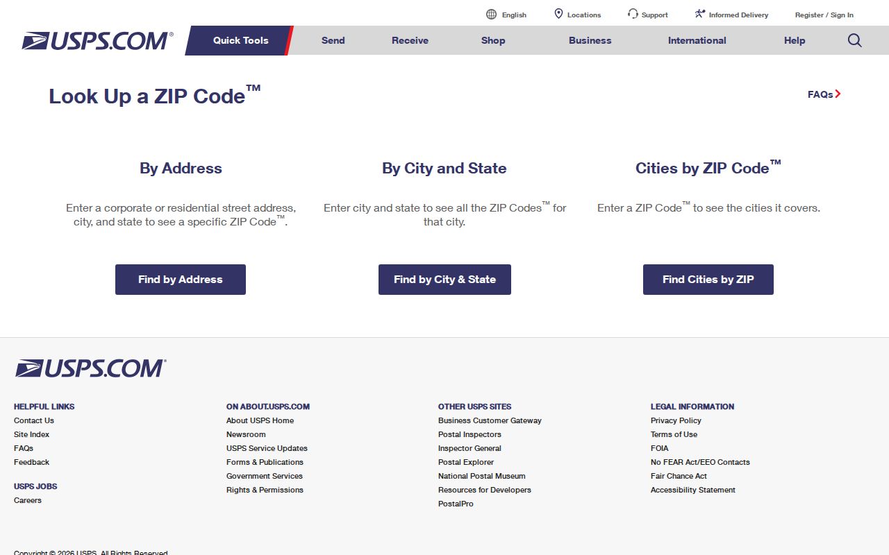
The result should be saved with the search date and the address wording used. If the returned city label differs from a local neighborhood name, keep both labels. That small record of the lookup helps explain later differences between postal, municipal, and county results.
Finding San Ramon Residents by ZIP Code
A postal directory cannot produce a verified citywide list of residents from one switch. San Ramon’s local tools divide the work among postal verification, parcel geography, ownership records, and lawful access rules. The sequence below keeps a ZIP from being mistaken for a person index.
- Verify the street address, city, and state with USPS. Use the address mode for one location, or the city and state mode to check the two principal San Ramon delivery ZIPs.
- Open CCMAP and search the address or APN. Capture the parcel boundary, APN, situs address, map context, and any nearby parcels. CCMAP supports map browsing, aerials, contours, and radius selection, but no documented ZIP-wide resident export.
- Use Contra Costa Assessor Maps and Property Information or ParcelQuest Lite with the APN or street address. The documented keys are APN and street address, not ZIP. Owner names are omitted from the county web presentation, so ownership requires the public assessment roll counter or a permitted request.
- Do not treat My Voter Status as a ZIP search. The California self-lookup authenticates one voter. A voter-file request is limited to approved statutory purposes and is not a personal ZIP directory.
- Once the ZIP narrows the geography, move to a street and address chain. The San Ramon street directory approach is the next step when the question is about parcels, owners, permits, or the address record rather than postal coverage.
The result is a set of verified address leads, not a claim that every household member has been identified. A ZIP search works best for geography, outreach to a known location, and family-history sorting.
USPS Fields for a San Ramon ZIP Code Search
The USPS modes use different required fields. Treating them as one search form causes false matches, especially when a researcher begins with a ZIP but means to verify an address. The field map below keeps the three routes separate.
| Search Mode | Required Fields | What It Answers |
|---|---|---|
| Address lookup | Street address, city, state | Which ZIP is assigned to a particular delivery address. |
| Cities by ZIP | ZIP | Which city names or postal places are associated with that ZIP. |
| ZIPs by City and State | City, state | Which ZIPs USPS associates with the named city and state. |
| Find, Lookup, and reset controls | Depends on the selected mode | Runs the selected search or clears the form for a new test. |
For San Ramon, the address mode is the key check when a record has a street and city but an uncertain ZIP. The city mode is a discovery aid, not proof that every address bearing the city name lies inside the incorporated city.
San Ramon Postal Evidence Has Limits
A ZIP result and a parcel result describe different layers. The USPS result describes delivery geography. The assessor and CCMAP describe a parcel, its situs address, and physical characteristics. The legal description describes the land in words that can survive a street-name or number change. An owner mailing address is a separate assessment field and can point away from the situs. None of those fields, alone, proves who occupies the parcel.
The current Contra Costa parcel viewer adds a visual check. It lets a researcher search an address or APN, click the parcel, inspect aerial and contour context, and select adjacent parcels or a radius. It is a map and parcel-information tool, not a ZIP-wide residents directory.
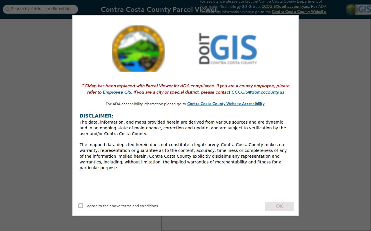
The map view is useful when a ZIP search produces several similar street names or when an older description must be tied to a present parcel. Save APNs and map references, then seek the appropriate county record rather than inferring household facts from a colored boundary.
Note: A matching ZIP and city label can still conceal a jurisdiction, parcel, or historical-record difference that only a map and date check will reveal.
San Ramon Postal Boundaries and City Limits
Postal boundaries and city limits answer separate questions. A ZIP identifies a delivery area. San Ramon’s incorporated boundary identifies municipal authority. Annexation changes can place a parcel inside the city while older permits, plans, or land-use decisions remain in county files. A San Ramon mailing label is therefore not conclusive proof that a parcel was inside the city on the date of an event.
- ZIP code
- A five-digit USPS delivery area used to route mail. It may cover geography that does not match a city boundary.
- ZIP+4
- An added four-digit delivery segment that narrows routing within a five-digit ZIP. It is more precise for mail, not a public resident list.
- PO-box ZIP
- A ZIP assigned for post-office boxes or a limited postal function. No verified San Ramon PO-box-only code was found in the research.
- Unique ZIP
- A code assigned to one large organization or special delivery point. No verified San Ramon unique code was found.
- Carrier route
- A postal delivery route within a ZIP. It helps mail operations but does not disclose a household directory.
The same distinction protects historical work. A directory, deed, or census record may use a place name that predates today’s municipal line. Record the address, date, APN, and source label together.
San Ramon Annexations Behind ZIP Geography
San Ramon incorporated in 1983 and then grew through a series of annexations. The official San Ramon annexation map legend identifies the original incorporation boundary, Canyon Lakes phases from 1986 through 1994, Central San Ramon in 1987, Thomas Ranch in 1998, Dougherty Valley annexations 1 through 18 from 1998 through 2020, Henry Ranch in 1999, and Faria Preserve in 2008. These are jurisdiction clues, not ZIP realignment dates.
The annexation legend capture makes the named sequence visible beside the postal geography.
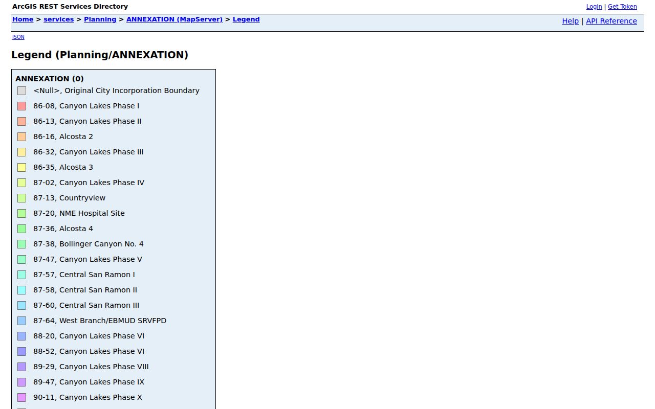
The map legend is useful for choosing the likely government custodian for an older address event, but it does not establish a ZIP change or identify residents.
One of the successful city GIS captures is the official San Ramon HOA boundary and name layer. It demonstrates why local polygons must be read carefully beside postal geography. The layer contains more than 90 named associations and boundaries, but it is not a ZIP map and does not list members.
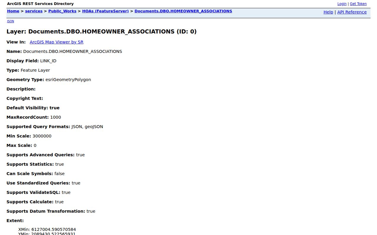
The association layer can help explain a neighborhood name attached to an address, while the annexation layer helps identify which government records may hold an older event. Neither layer changes the USPS result. Together they show why a strong San Ramon ZIP code directory is a starting map, not a substitute for a dated parcel and records check.
The city neighborhood information is another public orientation layer. Use it for local names and geographic context, then verify the actual parcel and custodian before drawing a conclusion about a resident or past household.
Note: No authoritative source verified a citywide ZIP realignment year, exact ZIP polygons, nearby ZIP list, or per-ZIP resident statistics for San Ramon.